Wednesday, October 1, 2008

Made Official

1 October 2008

I fear that my nation will not have record of its political establishment since the first of June, this year. My brother, who has tried to singlehandedly run Mindrimon's dire international problems, has developed a mental illness under all the stress. In a fit of frustration, he destroyed all the records that he has written beginning in June (early in June, the United Kingdom claimed part of the northern coast of the island). Once I got wind of his condition in Lithuania, I put aside my past shame and decided to step back into the country we founded. That was a month ago, and since then I have been working with NATO night and day to make a deal on the ownership of the island.

I am now overjoyed to report that my efforts this month have put order into the mess this phenomenon has created. It has been made official, yesterday, that every country that claimed a piece of the island will keep a piece. However, a great percent of the land we lost has been returned to us. Mindrimon now makes up nearly seventy-five percent of the mainland, as opposed to twenty-five before I started negotiating. I think that the people have accepted me back for my success with this compromise. My head feels empty at the moment, as the idea of this turmoil being over has not gotten to me yet. All that is in my mind now is to sleep for a week to recover from a month of sleepless nights. This is the political map that was agreed on yesterday:


Ian is currently in bed, and it does not look like he will be well in the near future. When I phoned him to report the good news, he paused for a long time, then asked me the meaning of the word compromise. I pray for him every night.
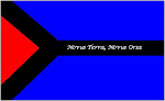
- Hans Mindrim

-- Mindrim expedition records

Sunday, June 1, 2008

Perspective II

1 June 2008

It has been an awful month. I have not written any complete entries into the records because I have been totally overwhelmed by recent events. Lets start off by saying that the rumors were correct. One by one, our island has been divided by three other nations, Germany, Norway, and Denmark. I have had to scramble to each location to stop their advancing borders. One case in which I was too late was when Germany penetrated our borders all the way up to the northern coast. Take a look at a map of the island not:

We dare not make a move to retrieve our borders in fear of a major international incident. The Icelandic government has warned us not to take any actions without their approval. haha

I really wish Hans was here because this is definitely not a one man job. He has not been back on the island since the first mistake he made when dealing with The Netherlands. In fact, he has fled the coastal waters and now takes refuge in Lithuania where our uncle's family lives. I hope that he was here, for I still believe that he is a better politician than I am.

For now we wait.
- Ian Mindrim

-- Mindrim expedition records

Thursday, May 1, 2008

Perspective I

1 May 2008

Today we bitterly reflect on Hans' deal as we receive some new maps of the island in perspective to the rest of the North Sea. Here is a copy of one of them:

There is a group of islands off of the northern coast that we have not mentioned yet. These islands were also included in the deal.

Hans is still in isolation on his boat. He dares not return because of a rumor that is going round. They say that Germany, Norway, Denmark, France, and Sweden have received leaked information about our deal with the Dutchmen. Many fear that these countries will take try to colonize the island, also. Most still blame Hans for everything.
- Ian Mindrim

-- Mindrim expedition records

Sunday, March 30, 2008

Split

30 March 2008

Hans has come back to the camp today, bringing the first political map of the island. Here is a copy:

You can see why we are all outraged. When he told us he had given the peninsula, we though he meant the small one, not the entire southwest section of the island. He also threw in the southeast islands as a deal sweetener - totally unnecessary. Nearly everyone is about the revolt, and Hans had to hide away on his boat to escape being mobbed. Another concern this brings up is the the threat of other nations being encouraged to colonize the island. Seeing the vast amount of land Hans gave the Dutchmen right away, they might be tempted to try the same thing. I don't even know what we will do if they do.

On a bit brighter note, we have officially starter building permanent structures in the basecamp. Also Some have started building a new, permanent town further east along the coast, since that area seems very good to settle in.
- Ian Mindrim

-- Mindrim expedition records

Friday, March 28, 2008

Confrontation and Discovery

26 March 2008

Hans has called us this morning to tell us about the outcome of his visit to the southwest part of the Island. The news is not good. He met a group of 45 Dutchmen who have indeed settled on that part of the island. More over, they have officially claimed the island! Hans could not accept this, so he made a deal with them to let them keep the area around their camp (we will have to wait until he gets back for the precise map). He made this decision by himself because he feared that the Dutchmen would not accept his offer if it was made any later.

Everyone was shocked and outraged by this news. Some blamed Hans for not consulting everyone first, but I, for one, see his reasons. Frans Derzit is worried that his early prophecy about international war may be coming true. I dearly hope we can settle this peacefully.
- Ian Mindrim

-- Mindrim expedition records

28 March 2008
The search team for the lost submarine Manta Ray was found near the northern coast of the North Sea Island. When scientists first saw what looked like the tail end of a submarine on the sonar screen, they were in disbelief. The front end seemed not to be broken off, but buried in the ocean floor. Further investigation by a submersible identified that the submarine was swallowed up by a thick blanket of volcanic rock. Some say that this gives even more proof of the layer theory concerning the creation of the island. The United States authorities have not made a statement about the find, but one of their vessels was spotted near the spot. This has lead some to speculate that the U.S. had already known about the location for some time, just had not revealed it.

-- Norwegian newspaper excerpt

Sunday, March 23, 2008

Swarm

23 March 2008

Many days ago, Franse Derzit's expedition came back with huge findings and conclusions. This event has triggered a swarm of researchers form many countries to come here and study this island. Our population has more than double, and we allow almost everyone who wishes to enter our camp. We have also heard rumors that a team from the Netherlands has decided to take their own peace of the island. The rumors tell that they have made their own camp on the South West part of the island. As we have not formally claimed this land, it seems we are going to have to start. We have sent a team led by Hans to investigate this rumor. On the bright side, many different expeditions are coming and going and bringing us much information about the island. A surveying team from Great Britain has given us a rough map of the elevation levels. Here is a copy of it:

It turns out that our small island has some pretty high peaks. The tallest is 3129 meters tall (about 9000 feet). We had only found out about the two massive lakes a few days ago. We guess that this water was trapped my the island's chaotic formation from the ocean, since the water in them is not fresh, but saline.

Our population as of today is 215 individuals, not including the rogue Netherlands team or the ones that are camping away from the central base of operations. I have stopped marking individual reasons of entrance and departure. There has been so much coming and going that a single man can not keep track of all of it.
- Ian Mindrim

-- Mindrim expedition records

Thursday, March 6, 2008

Looking Further II

01 March 2008

Today is the two month anniversary of humans visiting this remarkable island. We have definitely noticed changes here since we first landed. More and more birds are being seen near and around our camp, and we have caught fish just off the coast. The planting mission is doing very well, also. We already have many young plants in our planting grounds. Some saplings have grown also, and we have marked the first one that came up as a major historic event (27 February). The garden around the Merchevic monument is blooming spectacularly. We are all very pleased with the island's progress.
- Hans Mindrim

06 March 2008

Frans Derzit has declared his findings to the world today! We have all been anxiously waiting for his conclusions ever since he got back, five days ago. He has refused to let anyone outside of his team anywhere near his tent. It has pushed Hans to the brink of explosion. He seems to be the most anxious out of all our party.

Anyway, back to the report! Derzit has gathered that the jets of steam and water on the interior of the island are newly forming geysers. They are greater than any others seen on earth because of the strange formation of the island. According to widely accepted hypothesis, a huge magma chamber bellow the surface burst all at once, creating the huge peace of land. The eruption was not a single vertical uprising, but a series of huge blankets which trapped large amounts of water under them. Heat from the magma still underground heated this trapped water to great temperatures until the pockets exploded upward through the surface. It is predicted that many of these pockets of super heated water have yet to erupt, so settling further inland should be postponed. The expedition has not come across constant geysers, which makes sense since no aquifers could have been formed yet. These findings confirm the island's volcanic origin.
- Ian Mindrim

-- Mindrim expedition records
Blog Directory - Blogged